Data quality
Traditional
Fragmented & inconsistent
Vertify
Uniform / 100% coverage

Vertify makes NYC facade inspections better, faster, and cheaper. Our FAA-licensed drone pilots deliver 100% facade coverage, centimeter-accurate imagery, and turnaround measured in hours, not days.
No scaffolding. No blind spots. No paying crews to climb your building.
We're purpose-built for the NYC market and the DOB's facade inspection standards. Every flight is planned to your QEWI's TR-6 evidentiary standard, from the first frame to the final close-out filing.
Fragmented & inconsistent
Uniform / 100% coverage
$$$$
$
1–2 weeks
1 day
Yes — 60+ days
No
Significant
Minimal
Visual + photo
0.4 mm/px + thermal
Re-mobilize
Minimal
Elevated
Eliminated
The Metlife Building (200 Park Avenue) is one of the largest office towers in Midtown, with a facade most inspection firms would need weeks to cover. Vertify flew the full envelope in a single day and delivered high-resolution, navigable imagery of every elevation.
Six phases, one dashboard. Building owners and QEWIs see the same evidence the same day — no surprises 30 days before a SWARMP filing.
Schedule a scoping callFAA LAANC + NYC airspace clearance, building owner notice, QEWI scoping call.
Two-pilot crew, redundant capture: 0.4mm/px RGB, thermal IR.
Facade imagery delivered as fully navigable 2D model on Vertify platform
Vertify tags spalls, cracks, and other repairs, geo-located on the model
Your QEWI partner reviews findings, signs the TR-6, files with NYC DOB.
Annotated model, and repairs archived on Vertify forever.
Every flight produces a stacked dataset your QEWI can interrogate for years — not a folder of JPEGs.
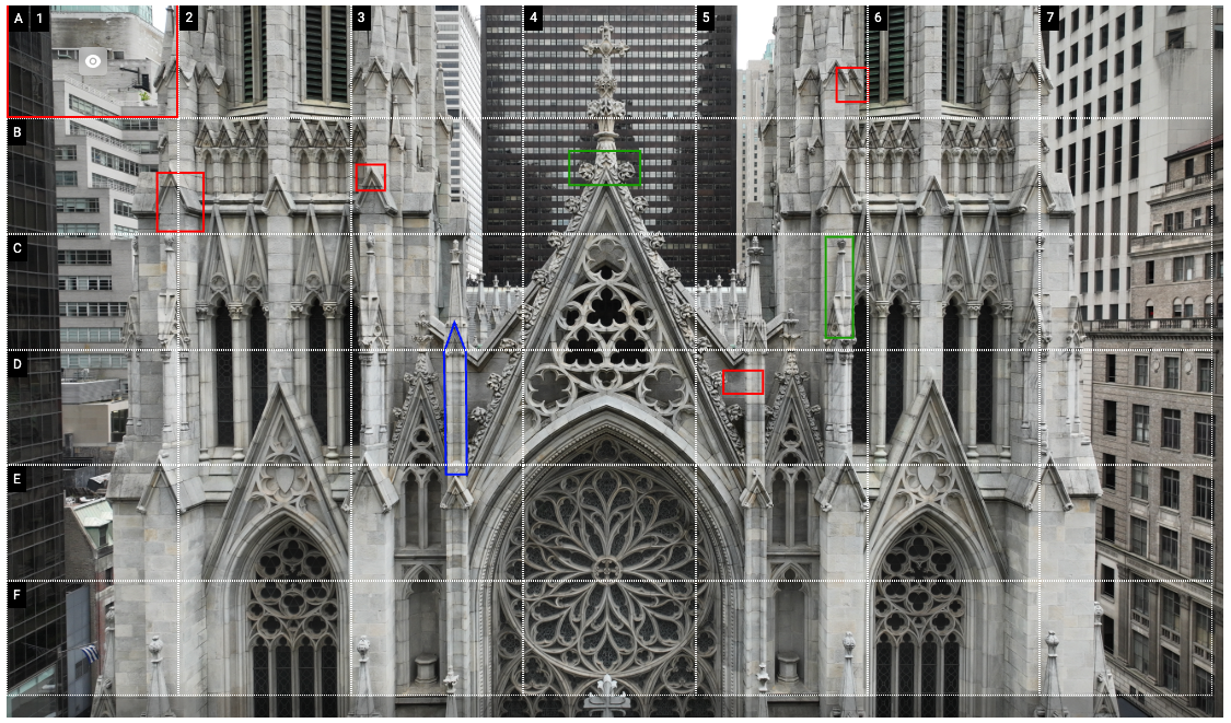
DJI Matrice 4E with a 4/3 CMOS wide-angle and 48MP medium tele camera. Each tile is geo-referenced and stitched into a centimeter-accurate orthomosaic. Read serial numbers off lintels, count mortar cracks per square foot.
FLIR XT2 thermal — surface a delaminated brick or a saturated cavity wall a full FISP cycle before it spalls.
Defects auto-classified (cracks, spalls, displaced units), tagged to elevation + grid, exported as the QEWI's preferred deliverable.
Each defect ships with photo, location, severity, suggested repair scope. Sync to your CMMS or download as CSV.
Re-fly any time. Overlay the deltas. Prove defect progression or repairs to ownership and the DOB.